Galicia Maps & Indexes
Die deutschen Siedlungen in Galizien (The German Settlements in Galicia)
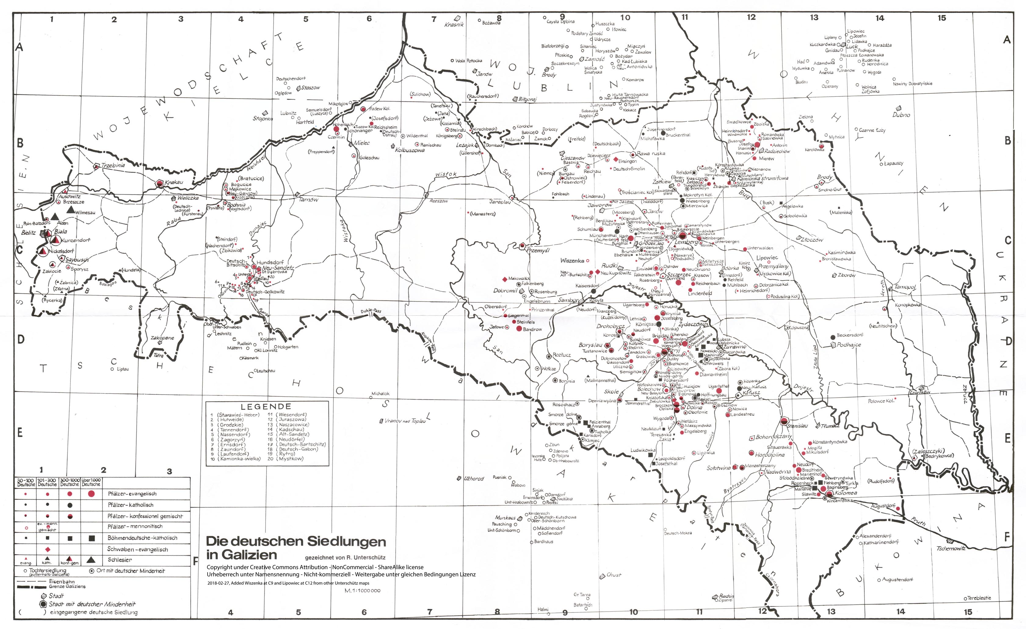
German Settlements in Galicia circa 1939, A: Whole B: West part, C:East part
© Rudolf Unterschütz with permission
A detailed black & white version of the map above is available at this link
(PNG format, courtesy of www.semanchuk.com)
Dave Gorz has written an index to this map available here.
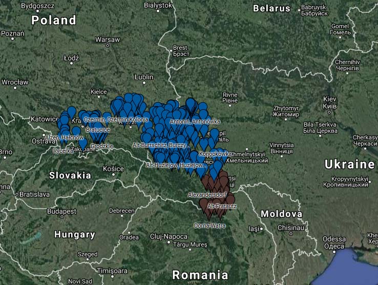
German Settlements in Galicia & Bukovina in Google Maps
Google Map with Austrian Military Map links
Click on this Link or the Map above to view the Interactive Map Courtesy of Dennis Bender and Sandy Schilling Payne of
Germans from Russia Settlement Locations
Villages will show the exact modern location. Also given are information about each village and links to the 1869-1887 Austrian Military survey showing the German village. Pick from a list or click on the magnifying glass icon to search for a village. Scroll lower in the left column and click on the https://mapire.eu link or a modern Google map. In Mapire, use the scroll wheel or click on the [ + ] or [ - ] boxes to zoom in or out. Choose your base layer and Opacity to change the 100% transparency to 0% to see your chosen modern-day map.
Other maps of Galicia
Modern and historical maps of Galicia including very detailed 1:75,000 Military maps and Gazetteers which help you locate your ancestors village.